Geospatial
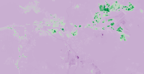
NDVI computation from satellite imagery
A little step into the remote sensing world through the computation of the NDVI (Normalized Difference Vegetation Index) based on Sentinel-2 satellite data. The aim of this index is to assess whether or not the target being observed contains live green vegetation. (NOTE: it may take a while to load)


